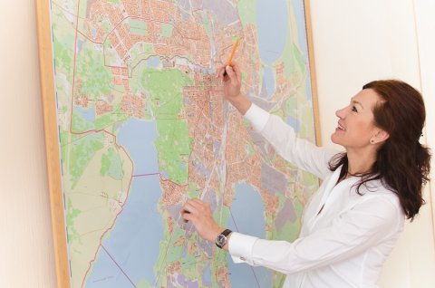
This Year the geodesy and cartography sector in Russia celebrates its 100th anniversary. The modern history of the state cartographic and geodetic service began on March 15th of 1919, when a Decree on creating a Supreme Geodetic Department came into force as proposed by the Council of People’s Commissars of the Russian Soviet Federative Socialist Republic. How did this sector develop throughout the last century, and what significance it has now? Director of the SUSU Geoinformation Systems Research and Education Centre Valentina Maksimova shares her thought on these issues.
– Why is the geodesy and cartography sector important?
– The geodesy and cartography sector is strategically important for all spheres of life. Specialists have been and keep making great efforts for the creation and updating of a unified coordinate space of Russia. Why do we need this? Because land is used to build cities, roads, plot agricultural lands, various industrial facilities, important strategic military facilities, and so on. And all of those must be interlinked into a unified coordinate space, so that there were no clashes in the work of different authorities, when for instance, a decision is made to build a road across some privately-owned premises, or build an industrial enterprise there.
– How did the geodesy specialists work in the past century?
– It took some time for the geodetic traditions, main scientific schools, approaches and methods to appear. Germany was among the most advanced countries in what concerned geodesy and cartography back then, so all the scientific and professional terms were borrowed from German. Geodesy is based on advanced mathematics, and there is even a separate field called Higher Geodesy. The profession of a geodesist is quite complicated. You can imagine in what conditions we had to work earlier! Specialists had to cover the huge territory of the USSR to install a lot of geodetics stations and assign coordinates to them: latitude, longitude and elevation. All of that was then recorded into catalogues and added to the unified state system. Geodesists used special devices: theodolites, levelling instruments, distance gages, and others. This work was carried out on the whole territory of the Soviet Union: on the far north, on lands which could have only been reached in a helicopter, and in impassable wilderness. And all of that was required in order to create a correct cartographic geo-coordinate background. At first simple timber stations were constructed, and later in the 60s and 70s, scaffold signals and beacons – geodetic reference benchmarks – were created. With their help maps were drawn and updated. Now the technologies are light years away from that, and satellite and laser geodetic equipment is used for work.
– And how is cartography used at present?
– There is not a single industry which does not use maps, be it construction, agriculture, forestry, or water economy. One cannot imagine education without maps either. In the process of training not only geographical maps are use, but also thematic ones, which are again based on geographical maps. For example, there are maps providing information on the condition of flora and fauna, location of mineral resources, average level of unemployment, and much more. And already based on the thematic maps we can solve different social and economic tasks. For instance, we can visualize the degree of agriculture development in districts, which influences the income level and the quality of life of the population, as well as the number of settlements, the infrastructure and roads, etc.

– And how are maps used in the era of modern technologies?
– Today cartography is transiting into the digital space, and this is directly related to geoinformation systems. In modern society the classical cartography undergoes changes, and digital maps have become widely spread. Such easily available services as 2GIS, or Yandex.Probki (traffic jams service) are well-known for users – we can mark certain locations there ourselves, like for instance, coffee-bars and offices we know of, or places with heavy traffic, and we can even add some descriptions and meanings this these marks – open hours, average bill, and so on. Using the Google Earth application you can take a look at any tourist attraction in 3D. These maps are not just popular and convenient, they are in demand among businessmen and top managers, who made managerial decisions based on geoinformation systems.
The geodesy and cartography sector is now entering people’s lives, starting from 10-year-old kids to senior users. Thanks to this sector you can find relevant information in any sphere. All of this makes the perception of the world easier. While still at home or being on the road and just using our phone, we can map the shortest route to our destination, or estimate the time on the road, or find our way around a strange place.
– Which projects are being fulfilled by the Geoinformation Systems REC? How do modern technologies help you in your work?
– We are developing the technologies for digitalization of the Chelyabinsk Region’s agricultural industry. We are performing projects on the inventory survey of the city and region infrastructure. For example, we’ve been updating the address tables. We were marking all the facilities located on the territory of South Ural region: apartment blocks and private residences, commercial property facilities, etc. We have created a big map of buildings of the whole region, from small villages to big cities. For these buildings we added information on the date of construction, date of the recent overhaul, number of storeys, and data on the type of rooms – residential or non-residential premises.
We also often take on projects for the mining industry, create photorealistic 3D models of different territories, like open pits or refuse piles. Geodesists perform works on site, to be able to see the actual condition of the already existing mining facility or to determine how something new will be designed. It is enough to perform a photo survey using an unmanned aerial vehicle, upload data to the SUSU supercomputer, where these data will be seamed together, and as a result a 3D model of an open pit or a dump is produced. It is possible to automatically calculate the volume of output or the volume of rock remaining in the dump or refuse pile.
If a common geodetic method were used, such work would have taken six months, but the new technologies allow to complete this task in just three weeks! All of this facilitates making these works faster and at a cheaper price. Using the 3D survey and geodetic technologies we can produce maps featuring all the details of the relief. There is high demand for all of it, and such work is part of our research innovations, methods and new approaches.


.JPG)
